Road Sentinel
See more of the road. Make better decisions.
Road Sentinel gives vehicles more information about the road ahead and gives cities a continuous record of how traffic moves. Elevated roadside sensors support safer travel, faster traffic studies, and better decisions across a corridor.
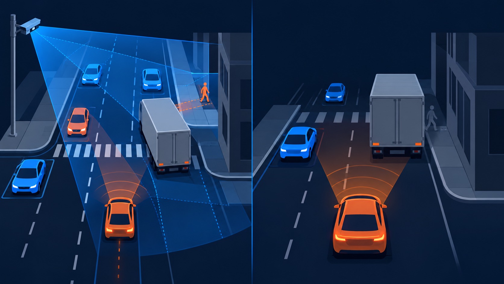
One system serves the road and the people who use it.
Infrastructure View
A vehicle sees from its own position. Roadside sensors add observations from a higher angle and farther along the road. Compatible onboard units and mobile devices can receive those observations over Bluetooth. The receiving system decides how to use them.
Road Network Intelligence
Cities and road teams can study counts, speed, turns, queues, near misses, closures, and emergency access from the same movement record. Existing observations can support a focused signal-timing analysis in minutes instead of commissioning a new study that may take weeks or months.
Use the road record for the decision in front of you.
A prototype is built. Field validation comes next.
Upcoming tests will measure sensing, device communication, installation, and data quality on controlled courses and real roads. Results will be published against the verification plan as they become available.